Business Details
45 Years
experience
Expert Florida Surveying & Mapping Services
PEC Surveying and Mapping has been delivering comprehensive surveying and mapping services for governmental and private development projects in Florida since 1981. Originally part of a 36-year-old civil engineering firm, we transitioned into a dedicated surveying and mapping practice, leveraging decades of collective experience from our team of licensed Professional Surveyors and Mappers. Our principals remain actively involved in daily operations, ensuring hands-on expertise and accountability. We utilize state-of-the-art field and office equipment to provide cost-effective, accurate solutions tailored to clients' needs. Our long-standing relationships with Florida governmental agencies enhance our ability to navigate regulatory requirements efficiently. With over 40 years of experience, we specialize in land development, construction staking, transportation surveys, and GIS integration.Our commitment to quality is reflected in our rigorous Quality Assurance/Quality Control Program, which emphasizes direct principal involvement, equipment calibration, and peer review. We have successfully completed surveys for tens of thousands of residential lots, regional malls, and major infrastructure projects, including interstate highways. Our GIS team, with over 15 years of continuous experience, supports complex projects ranging from pipeline construction to large-scale environmental assessments. PEC Surveying and Mapping remains a trusted partner for clients seeking precision, timeliness, and unwavering dedication to project success.
Services
Land Development Surveying
Construction Surveying
Transportation Surveys
Engineering Design Surveys
ALTA Surveys
GIS Mapping
Right-of-Way Mapping
Expert Witness Services
Details
- Year established: 1981
Highlights and features
- We offer 40+ years of Florida-specific surveying experience.
- Our principals maintain direct involvement in all projects.
- We utilize state-of-the-art surveying and GIS technology.
- We perform ALTA/NSPS standard commercial property surveys.
- Our team includes certified survey technicians and GIS experts.
Services
Land Development Surveying
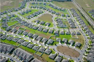
Our land development surveying services cover boundary determination, topographic mapping, and subdivision plats for residential and commercial projects. We provide due diligence surveys, engineering design support, and as-built documentation for regulatory approvals. With over 13,000 units platted, our team ensures compliance with local jurisdictional requirements while maintaining project timelines.
Construction Surveying
We deliver construction staking for residential, commercial, and infrastructure projects including roadways and high-rise buildings. Our services verify geometric integrity of plans, document construction irregularities, and prepare final as-built surveys. Daily activity logs ensure accurate record-keeping and compliance with Florida counties' specific requirements for project approval.
Transportation Surveys
Specializing in transportation infrastructure, we conduct design surveys and right-of-way mapping for state, county, and city roadways. Our team prepares legal descriptions conforming to Florida statutes and supports eminent domain proceedings with detailed exhibits. We've completed over 55 miles of transportation corridor surveys for FDOT and local agencies.
Engineering Design Surveys
We provide base mapping for drainage studies, water treatment facilities, and pipeline improvements. Our surveys support civil engineering projects including 90+ miles of water and sewer line upgrades. Long-term contracts with municipal agencies demonstrate our ability to maintain consistent data standards across multi-year infrastructure programs.
ALTA Surveys
We perform ALTA/NSPS standard surveys for commercial real estate transactions, including title verification and site improvement documentation. Using GPS and electronic total stations, we reduce field time while meeting title insurance requirements. Our surveyors have completed assignments for regional malls, office complexes, and convenience store chains.
Questions
What geographic areas do you serve?
We specialize in surveying projects across the state of Florida, with extensive experience in Central Florida counties.
What types of surveying services do you offer?
Our services include land development surveys, construction staking, transportation surveys, ALTA/NSPS commercial surveys, and GIS mapping solutions.
How experienced is your team?
Our principals have over 40 years combined experience in Florida surveying, with certified technicians and GIS specialists supporting all projects.
Do you handle government projects?
Yes, we're pre-qualified by the Florida Department of Transportation and have completed surveys for numerous municipal agencies since 1984.
What technology do you use?
We employ GPS receivers, electronic total stations, and advanced GIS software to ensure accuracy and efficiency in all surveying tasks.