Business Details
50+ Years
experience
Your Trusted Partner for Land Surveying Solutions in Weston, WI
Vreeland Land Surveyors & Engineers has been a family-owned and operated business since 1970, serving clients across North Central Wisconsin with precision and dedication. Our team combines three generations of expertise with the latest technology to deliver accurate land surveying and civil engineering solutions. We prioritize customer service, ensuring projects are completed efficiently while maintaining cost-effectiveness through low overhead. Our commitment to professionalism is reflected in our ongoing continuing education and adherence to industry standards. With decades of experience, we provide tailored services for residential, commercial, and municipal projects, ensuring client satisfaction through personalized attention and reliable results.Our team goes beyond technical capabilities, focusing on building long-term relationships and understanding client needs. We specialize in ALTA/NSPS surveys, boundary delineation, floodplain analysis, and stormwater management, meeting both state and federal requirements. Our deep knowledge of local regulations streamlines permitting processes and reduces project delays. By balancing technical excellence with approachable service, we ensure clients receive solutions that align with their timelines, budgets, and objectives. This philosophy has earned us a reputation as a trusted partner for surveying and engineering needs in Wisconsin.

Services
ALTA/NSPS Surveys
Boundary Surveys
FEMA Elevation Certificates
Stormwater Management
Topographic Mapping
Subdivision Planning
Erosion Control Plans
Floodplain Analysis
Site Development
Wetland Permitting
Details
- Year established: 1970
Highlights and features
- We offer three generations of experience in land surveying and civil engineering.
- Our team utilizes the latest technology for precise and efficient results.
- We prioritize cost-effective services through low overhead and streamlined processes.
- Our commitment to continuing education ensures adherence to evolving industry standards.
- We provide personalized service tailored to residential, commercial, and municipal project needs.
Associations and certifications
- National Society of Professional Surveyors
- American Land Title Association (ALTA)
What people say
Very responsive and good service
Outstanding job
Prompt service
Fair cost
Always helpful
Services
ALTA/NSPS Surveys
ALTA/NSPS Land Title Surveys meet national standards for commercial real estate transactions. These detailed surveys map boundaries, easements, and improvements to ensure compliance with lenders and title companies. Our team collaborates with attorneys and municipalities to deliver accurate, code-compliant documentation for property transfers and development projects.
Boundary Surveys
Boundary Surveys establish legal property lines using historical records and field measurements. This service verifies deed accuracy, resolves disputes, and supports real estate transactions. We provide clear documentation and physical markers to ensure clients understand their land's exact dimensions and legal status.
Stormwater Management
Stormwater Management Plans prevent erosion and comply with Wisconsin DNR regulations. Our engineers design detention basins, grading solutions, and pollution prevention systems for residential and commercial developments. Services include permitting assistance and site-specific strategies to manage runoff effectively.
FEMA Elevation Certificates
FEMA Elevation Certificates determine flood risk for insurance and permitting. Our licensed surveyors use certified equipment to document structure elevations relative to floodplains. We assist with LOMA applications to remove properties from high-risk zones, reducing insurance costs for homeowners and businesses.
Topographic Mapping
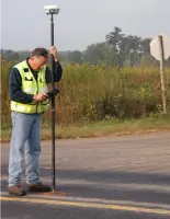
Topographic Mapping documents land features like elevations, vegetation, and utilities. This data supports site planning, construction, and environmental assessments. We use GPS and GIS technology to create detailed, scalable maps that guide development and regulatory compliance efforts.
People
Dustin Vreeland
Project Engineer
Dustin Vreeland, a Wisconsin-licensed Professional Engineer, has worked with Vreeland since 2006. He specializes in nonmetallic mining operations, floodplain studies, and stormwater design. Dustin holds certifications in Winslamm and HEC RAS software and is pursuing his Professional Land Surveyor license.
Timothy G. Vreeland
Owner
Timothy Vreeland, owner of Vreeland Land Surveyors & Engineers, has over 30 years of experience in the field. He earned his license after seven years of apprenticeship and 16 hours of testing. Tim focuses on client relationships and technical oversight, ensuring projects meet strict regulatory standards.
Judy Vreeland
Owner/Secretary
Judy Vreeland co-owns the business and manages office operations, fieldwork, and client communications. With 35 years of experience, she holds a notary commission and plays a key role in project coordination and administrative leadership.
Questions
Do you provide stormwater management plans in Weston, WI?
Yes, we design site-specific stormwater plans meeting WDNR and municipal requirements, including detention basins, erosion control, and permitting support.
Can you help with nonmetallic mining operations in Marathon County?
Yes, we offer surveying, reclamation planning, and compliance services for nonmetallic mines under Wisconsin Chapter NR 135 regulations.
Do you perform ALTA/NSPS Land Title Surveys?
Yes, our ALTA/NSPS surveys meet national standards for commercial transactions, including boundary mapping and lender compliance documentation.
Can you resolve property line disputes for home sellers?
Yes, our Mortgage Loan Service verifies property boundaries against deeds to resolve discrepancies during real estate transactions.
Do you offer topographic mapping services?
Yes, we create detailed topographic maps showing elevations, utilities, and physical features for development and planning purposes.
Can you assist with floodplain analysis and elevation certificates?
Yes, we provide FEMA-compliant elevation certificates and LOMA applications to help property owners reduce flood insurance costs.