Business Details
50+ Years
experience
Your Trusted Civil Engineering Partner in Cottonwood, AZ
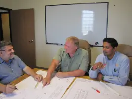
Since 1974, SEC has established itself as a trusted provider of civil engineering and land planning solutions in Sedona and Cottonwood, Arizona. Our interdisciplinary team combines expertise in civil engineering, structural engineering, land surveying, and environmental planning to deliver comprehensive, sustainable solutions for clients ranging from individuals to government entities. With decades of experience in Yavapai and Coconino Counties, we utilize advanced technologies like CADD, GIS mapping, and GPS surveys to address complex challenges. Our commitment to quality work is reflected in our team approach, which prioritizes economically and ecologically sound outcomes. We specialize in street construction plans, utility systems, land use reports, and environmental analysis, serving residential, commercial, industrial, and governmental projects across the western United States.Our staff's extensive education and technical proficiency ensure precise execution of projects requiring hydrology, forestry management, and NEPA compliance. By maintaining a focus on innovation and client collaboration, we consistently transform planning concepts into actionable realities. Our reputation for reliability is built on transparent communication and adherence to industry standards, making us a preferred partner for diverse development needs. Through continuous investment in staff development and technology, we remain at the forefront of civil engineering advancements while preserving our core commitment to community-focused solutions.


Services
Civil Engineering
Land Surveying
Environmental Planning
GIS Mapping
Hydrology Analysis
NEPA Compliance
Utility Planning
Land Use Reports
Structural Engineering
Forest Management
Details
- Year established: 1974
Highlights and features
- We utilize a team approach to problem-solving with 50+ years of local experience
- Our staff holds expertise in CADD, GIS mapping, and GPS survey technologies
- We provide interdisciplinary solutions combining engineering and environmental planning
- We specialize in projects requiring NEPA compliance and hydrology analysis
- Our all-encompassing approach ensures economically and ecologically sound outcomes
Services
Civil Engineering
Our civil engineering services encompass street construction plans, utility systems, and land development projects. We specialize in creating infrastructure solutions that balance technical requirements with environmental considerations. Our engineers apply advanced methodologies to ensure compliance with regulatory standards while optimizing project efficiency for residential, commercial, and governmental clients.
Land Surveying
We provide precise land surveying services including boundary determination, topographic mapping, and GPS-based measurements. Our surveyors utilize modern technology to deliver accurate data for property development and legal documentation. This service supports construction projects, land subdivisions, and environmental assessments with reliable spatial information.
Environmental Planning
Our environmental planning integrates ecological considerations into development projects through NEPA compliance analysis and natural resource management. We assess environmental impacts and develop mitigation strategies that align with regulatory requirements. This service helps clients achieve sustainable outcomes while maintaining project viability across diverse ecosystems.
GIS Mapping
We create detailed GIS mapping solutions that visualize complex spatial data for infrastructure and environmental projects. Our mapping services support decision-making through layered analysis of geographical features, land use patterns, and environmental factors. This technology enhances project planning accuracy and facilitates stakeholder communication across various development initiatives.
Hydrology Analysis
Our hydrology analysis services evaluate water resources and drainage patterns for development projects. We assess surface water management, floodplain mapping, and watershed characteristics to inform infrastructure design. This service ensures proper water system integration while addressing environmental protection requirements for sustainable land development.
Questions
What engineering services does SEC offer?
We provide civil engineering, structural engineering, land surveying, environmental planning, GIS mapping, and hydrology analysis services for residential, commercial, and government projects.
How long has SEC been in business?
SEC has served clients since 1974, providing engineering and land planning solutions across Arizona and the western United States for over 50 years.
What geographic areas do you serve?
We primarily serve Yavapai and Coconino Counties in Arizona, with project experience throughout the western United States.
What makes SEC different from other engineering firms?
Our interdisciplinary approach combines engineering expertise with environmental planning, utilizing advanced technologies like GIS mapping and GPS surveys to deliver comprehensive, sustainable solutions.
What types of clients do you work with?
We serve individual property owners, developers, municipalities, and government agencies requiring engineering solutions for residential, commercial, industrial, and infrastructure projects.