
Business Details
13 Years
experience
Your Trusted Engineering Partner in Columbia, KY
Founded in 2013, Precision Engineering has established itself as a trusted multi-disciplined consulting firm specializing in civil engineering, geotechnical engineering, surveying, and construction inspection services. Our team of licensed professionals, including Professional Engineer and Land Surveyor Stephen R. Harris, delivers innovative solutions across Kentucky, Tennessee, Ohio, Indiana, Alabama, and Georgia. With over a decade of experience, we have completed diverse projects ranging from educational facilities like Adair Middle School to infrastructure developments such as City Lake Dam geotechnical exploration. Our approach combines advanced technology, including UAV drone mapping and state-of-the-art laboratory testing, with core values of faith, honesty, integrity, and hard work.We maintain Professional Engineering licenses in six states and prioritize exceeding client expectations through comprehensive problem-solving and relationship-building. Our services span project lifecycle phases, from initial site assessments and boundary surveys to construction material testing and final inspections. By integrating cutting-edge tools like GPS units, robotic stations, and ground-penetrating radar, we ensure precision in every project. Our commitment to technical excellence is matched by our dedication to ethical practices and community-focused engineering solutions. As we look to the future, we continue to expand our capabilities while maintaining the foundational principles that have guided us since our inception.
Services
Civil Engineering
Geotechnical Engineering
Land Surveying
Construction Testing
Drone Mapping
Laboratory Services
Details
- Year established: 2013
Highlights and features
- Licensed engineers in six states with 10+ years of project experience
- Comprehensive services from site surveys to final inspections
- Advanced technology including UAV drone mapping and GPR
- Dedicated 2,000 sq ft laboratory for material testing
- Proven track record with municipal and commercial clients
Services
Civil Engineering
Our civil engineering team delivers comprehensive solutions for water supply systems, stormwater management, roadway design, and site development. With licensed professionals in six states, we handle municipal permitting, floodplain analysis, and construction contract management. Our expertise spans residential, commercial, and industrial projects, ensuring compliance with environmental regulations while optimizing functionality and cost-efficiency.
Geotechnical Engineering
We conduct detailed subsurface investigations to assess soil conditions and provide foundation design recommendations. Our services include expansive soil analysis, slope stability evaluation, and seismic classification studies. By identifying potential geotechnical risks early, we help prevent costly construction delays and ensure structural integrity for projects ranging from retaining walls to landfill developments.
Land Surveying
Our surveying department utilizes GPS and robotic technology for precise boundary, topographic, and construction layout surveys. We provide ALTA/NSPS standards compliance, deed research, and volumetric calculations. Services support infrastructure projects, property development, and legal documentation needs, with UAV drone capabilities enhancing data collection efficiency and accuracy.
Construction Testing
We perform field and laboratory testing of construction materials including concrete, soil, and asphalt. Our certified technicians conduct compaction tests, compressive strength analysis, and non-destructive evaluations. The 2,000 sq ft laboratory ensures quality control compliance with ASTM standards, supporting special inspections for foundations, structural steel, and seismic isolation systems.
Drone Mapping
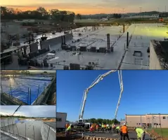
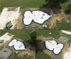
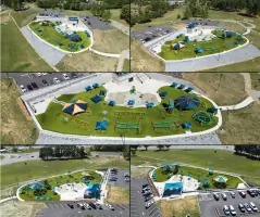
Our UAV fleet captures high-resolution aerial imagery for site documentation and topographic modeling. Drone mapping supports construction monitoring, volume calculations, and as-built surveys. This technology provides cost-effective data collection for large sites, improving project visualization and decision-making through accurate 3D representations draped over existing terrain models.
People
Stephen R. Harris
Founder & Professional Engineer
Licensed Professional Engineer and Land Surveyor with 10+ years of experience leading infrastructure projects across six states. Specializes in municipal permitting and multi-disciplinary engineering solutions.
Mark Billingsley
Surveying Department Manager
Licensed Professional Land Surveyor managing topographic, boundary, and construction surveys. Expert in UAV operations and ground-penetrating radar technology for utility detection and site analysis.
Trey Baston
Geotechnical Department Head
Professional Engineer specializing in subsurface investigations and foundation design. Leads geotechnical assessments for commercial and municipal projects, focusing on risk mitigation and site stability solutions.
John Barnett
Laboratory Manager
Certified Materials Testing professional overseeing concrete, soil, and asphalt analysis in our 2,000 sq ft laboratory. Ensures compliance with ASTM standards for construction material quality control.
Tucker England
UAV Pilot
Certified drone operator specializing in aerial mapping and construction site documentation. Utilizes UAV technology for topographic surveys and progress monitoring across diverse project types.
Questions
What engineering disciplines do you specialize in?
We provide civil engineering, geotechnical engineering, surveying, and construction material testing services with licensed professionals in six states.
Which geographic areas do you serve?
Our services cover Kentucky, Tennessee, Ohio, Indiana, Alabama, and Georgia with project experience across diverse municipal and commercial sectors.
What surveying technologies do you use?
We utilize GPS units, robotic stations, UAV drones, and ground-penetrating radar for boundary, topographic, and construction layout surveys.
Do you have in-house testing capabilities?
Yes, our 2,000 sq ft laboratory conducts concrete, soil, and asphalt testing per ASTM standards with certified technicians.
How do you handle geotechnical risk assessment?
We perform subsurface investigations and provide foundation design recommendations to mitigate risks from expansive soils, slope instability, and seismic factors.
Can you support full construction lifecycle projects?
Our services span from initial site surveys and design through material testing, special inspections, and final project documentation.