
Business Details
19 Years
experience
Trusted Construction Engineering Services in Evansville, IN
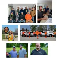
At Construction Engineering Solutions, we prioritize collaboration and client-centric solutions to deliver exceptional construction outcomes. Since 2007, our team has combined deep industry expertise with cutting-edge technology to address diverse project challenges across roadways, sports complexes, warehouses, and more. Our approach emphasizes understanding client needs, leveraging decades of collective experience, and maintaining a commitment to safety, quality, and efficiency.We pride ourselves on being a trusted partner throughout the construction lifecycle, from initial planning to project completion, while fostering a workplace culture rooted in integrity, teamwork, and continuous innovation.
Services
3D Scanning
Drone Imagery
GPS Surveying
Project Data Management
Quantity Verification
Remote Monitoring
Construction Staking
Details
- Year established: 2007
Highlights and features
- We offer 17+ years of specialized construction technology expertise since 2007
- Our client-first approach tailors solutions to unique project requirements
- We maintain a diverse portfolio spanning roadways, industrial facilities, and complex infrastructure
- Our team pioneers innovative uses of 3D modeling and drone technology
- We combine technical excellence with collaborative project management practices
Services
3D Scanning
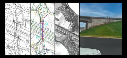
Our 3D scanning services create precise digital representations of physical environments using advanced laser technology. This enables accurate measurements, clash detection, and as-built documentation for construction projects. Clients benefit from improved project visualization, reduced rework, and enhanced decision-making throughout the building process.
Drone Imagery
We deploy drone technology for aerial data collection, generating high-resolution topographic maps and progress monitoring reports. This service provides cost-effective site analysis, volume calculations, and real-time project tracking while maintaining strict safety standards and regulatory compliance.
GPS Surveying
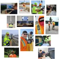
Our GPS and robotic surveying solutions deliver centimeter-level accuracy for construction layout and grading operations. By integrating field data with design models, we ensure precise implementation of project plans while minimizing material waste and labor inefficiencies.
Quantity Verification
We provide detailed QC/QA reports for material quantity verification using field measurements and digital modeling. This service ensures accurate payment documentation, reduces disputes, and maintains quality control through systematic validation of completed work.
Remote Monitoring
Our remote monitoring solutions offer real-time project oversight through connected devices and periodic drone inspections. This service maintains project continuity, identifies potential issues early, and provides stakeholders with timely progress updates and actionable data.
People
John Doe
Founder & CEO
With 25+ years in construction technology, John established CES in 2007 to bridge industry gaps through innovation. He leads strategic growth while maintaining hands-on involvement in complex projects.
Sarah Miller
Operations Director
Sarah oversees daily operations and client relations, ensuring seamless service delivery across multiple states. Her 15 years in construction management focus on optimizing field-to-office workflows.
Questions
What construction services do you specialize in?
We specialize in 3D scanning, drone surveying, GPS layout, quantity verification, and remote monitoring for commercial and infrastructure projects.
Do you work with both small and large construction firms?
Yes, we serve contractors of all sizes with scalable solutions tailored to project complexity and budget requirements.
How do you ensure project accuracy?
We combine advanced technology with industry best practices, including real-time data validation and multi-stage quality control processes.
Can you support projects in remote locations?
Our remote monitoring capabilities and mobile field teams enable support for projects in diverse geographic areas.
What technology platforms do you use?
We work with industry-standard software and hardware, including Trimble, Leica, and Autodesk products, while maintaining equipment agnosticism.