Business Details
32 Years
experience
Your Trusted Partner for Civil Engineering Solutions
AULtec is a progressive multi-disciplinary engineering firm specializing in civil and environmental engineering, land surveying, and geographic information systems. Founded in March 1994, we have built decades of experience delivering innovative solutions for public works, land development, and environmental projects. Our team combines hands-on expertise with cutting-edge technology to resolve complex design challenges efficiently. We prioritize client communication, keeping stakeholders informed at every project milestone while adhering to jurisdictional requirements. Our professionals are actively involved in every assignment, managing projects through collaborative team efforts to ensure successful completion.We invest in continuous education and technological advancements to maintain staff versatility and optimize service delivery. Our clients include federal, state, and local governments, as well as private sector partners across diverse industries. With licenses covering Maryland, Virginia, and Washington, DC, we deliver projects in AutoCAD, MicroStation, and ESRI platforms. Our commitment to quality is reflected in precision-driven services like stormwater management, GPS surveying, and 3D scanning. For over 25 years, AULtec has remained at the forefront of engineering innovation while maintaining a client-centric approach to community development.
Services
Civil Engineering
Land Surveying
GIS Mapping
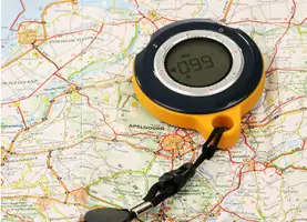
GPS Systems
Subterranean Tunneling
3D Scanning
Details
- Year established: 1994
Highlights and features
- We offer 25+ years of experience in civil and environmental engineering disciplines
- Our team utilizes cutting-edge technology including 3D scanning and GPS systems
- We maintain active licenses in Maryland, Virginia, and Washington, DC
- We provide comprehensive project management from planning to completion
- We invest in continuous staff training and technological advancements
Services
Civil Engineering
Our civil engineering services encompass site planning, road design, stormwater management, and transportation analyses. We deliver comprehensive solutions for public works projects, including school facilities, recreational areas, and hiker-biker trails. With decades of experience, our team provides expert construction inspections and hydrology studies to ensure regulatory compliance and sustainable development.
Land Surveying
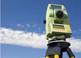
We offer full-spectrum land surveying including ALTA/ACSM standards, topographic mapping, and GPS surveying. Our licensed professionals use robotic total stations and millimeter-accuracy GPS for boundary determination, construction stakeout, and as-built certifications. We maintain equipment calibrated for federal highway projects and deliver data in AutoCAD and MicroStation formats.
Geographic Information Systems
Our GIS services integrate spatial data management, thematic mapping, and utility infrastructure attribution. We combine HEC-RAS floodplain modeling with GPS data to support stormwater management and environmental planning. Deliverables include ESRI-compatible datasets and custom map production for municipal governments and engineering firms.
Global Positioning Systems
We implement high-precision GPS for geodetic control networks, coordinate transformations, and construction layout. Our dual-frequency receivers track US and GLONASS satellites, achieving millimeter-level accuracy for ALTA surveys and tunnel alignment projects. We process data using NGS OPUS and CORPSCON software for state plane coordinate system conversions.
Subterranean Tunneling
We provide specialized tunnel surveying services including control transfer, alignment verification, and boring machine guidance. Our team supported the WSSC 5.34-mile Bi-County Water Tunnel project, establishing underground control networks and delivering support services for major infrastructure installations in Montgomery County, Maryland.
People
James A. Afful
President
James A. Afful leads AULtec's strategic direction with extensive experience in civil engineering and project management. He oversees operations and ensures adherence to quality standards across all service lines.
Eleanor A. Butler Afful
Director of Human Resources & Public Relations
Eleanor A. Butler Afful manages HR operations and community engagement initiatives. She ensures compliance with employment standards while fostering professional development opportunities for AULtec's technical staff.
Andre K. Moten
CADD/Project Manager
Andre K. Moten brings 32 years of experience in engineering drafting and survey data management. He specializes in AutoCAD Civil 3D, boundary surveys, and construction layout for transportation and public works projects.
Nukulu H. Thomas
Field Survey Technician
Nukulu H. Thomas has 14 years of field survey experience, including ALTA/ACSM land title surveys and GPS data collection. He leads field crews in boundary determination and topographic mapping projects.
James B. Veli
Senior Survey Technician
James B. Veli offers 34 years of surveying expertise, managing complex projects like Montgomery County's EMOC facility. He specializes in MicroStation V8 and field-to-finish survey workflows for infrastructure developments.
Questions
What engineering services does AULtec offer?
We provide civil engineering, land surveying, GIS mapping, GPS systems, subterranean tunneling, and 3D scanning services for public and private sector clients.
How long has AULtec been in business?
We've been delivering engineering solutions since our founding in March 1994, with over 25 years of industry experience.
Which geographic areas do you serve?
We operate primarily in Washington, DC, Maryland, Virginia, and New York, with capabilities extending to other jurisdictions as needed.
What technologies does AULtec utilize?
We employ advanced tools including 3D scanners, robotic total stations, dual-frequency GPS receivers, and modern CAD/GIS software platforms.
What project types do you specialize in?
We focus on public works infrastructure, stormwater management, land development, boundary surveys, and transportation projects for government agencies and private developers.