Business Details
Trusted Civil Engineering Services in Fort Wayne
Engineering Vision has been a trusted partner for civil engineering and land surveying services in Northeast Indiana for over three decades. Our expertise in storm water drainage solutions, boundary surveys, and construction planning has earned us a reputation for reliability and precision. We utilize cutting-edge technology like GPS and drones to deliver accurate surveys and innovative engineering designs. Our team's extensive experience in municipal infrastructure, residential developments, and commercial projects ensures clients receive practical, cost-effective solutions. We pride ourselves on providing straightforward technical advice and taking calculated risks to protect our clients' interests.With decades of combined experience, our licensed professionals have completed thousands of projects across Indiana's diverse landscapes. Our commitment to quality and integrity has made us a preferred choice for contractors, developers, and government agencies. We handle every project phase in-house, eliminating the need for multiple consultants. From preliminary site evaluations to final construction documentation, we maintain rigorous standards throughout our workflow. Our track record of successful projects demonstrates our ability to navigate complex engineering challenges while maintaining client trust.

Services
Land Surveying
Civil Engineering
Storm Water Drainage
Boundary Surveys
ALTA Surveys
Construction Plans
Floodplain Studies
Utility Design
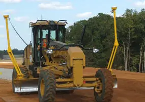
Site Grading
Aerial Photography
Highlights and features
- We offer 30+ years of engineering experience in Indiana's complex terrain
- Our in-house team handles all project phases from concept to completion
- We utilize GPS and drone technology for survey accuracy
- We provide direct technical guidance without evasive answers
- Our engineers have completed infrastructure projects across 42 Indiana counties
Services
Land Surveying
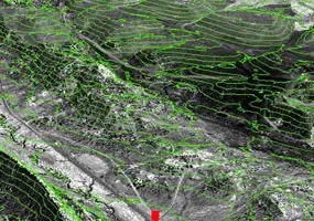
Our land surveying services utilize GPS and drone technology to create precise boundary, topographic, and ALTA surveys. With decades of experience in Indiana's terrain, we deliver accurate data for residential, commercial, and municipal projects. Our team handles legal drain conflicts, property line disputes, and easement locations while maintaining strict compliance with state regulations.
Civil Engineering
We provide comprehensive civil engineering solutions for water, sewer, and road construction projects. Our expertise includes storm sewer design, sanitary system planning, and road construction documentation. With experience in 42 Indiana counties, we create site-specific solutions that address zoning concerns, soil conditions, and environmental regulations while maintaining budget efficiency.
Storm Water Drainage
Our storm water drainage services focus on preventing flooding and managing runoff through engineered solutions. We design retention ponds, drainage systems, and flood control measures tailored to site-specific conditions. With experience in municipal infrastructure projects, we create systems that comply with environmental regulations while protecting property investments.
Construction Plans
We develop complete construction documentation packages including site grading plans, utility layouts, and road design specifications. Our in-house team creates detailed blueprints for residential developments, commercial sites, and municipal infrastructure projects. All plans incorporate topographic surveys and utility feasibility studies to ensure buildability and regulatory compliance.
Aerial Photography
Our aerial photography services use drone technology to capture high-resolution site imagery. This data supports boundary surveys, construction monitoring, and topographic mapping. The technology enables efficient data collection for large sites while maintaining survey-grade accuracy, reducing field time and project costs.
People
Mark L. Strong
President
Licensed Professional Engineer and Surveyor with 30+ years of Indiana experience. Designed 20+ miles of regulated drains, 9,000+ residential lots, and 60+ commercial sites. Managed infrastructure surveys for Fort Wayne's 20-year master plan.
Tod A. Mohr
Project Manager
Licensed Engineer and Surveyor with extensive experience in Fort Wayne developments. Managed over 30 projects including boundary surveys, utility design, and storm drain investigations. Conducted surveys for major commercial sites since the 1980s.
Questions
What engineering services do you specialize in?
We specialize in civil engineering and land surveying services including storm water drainage, boundary surveys, construction plans, and floodplain studies for residential, commercial, and municipal projects.
How long have you served the Fort Wayne area?
Our team has provided engineering services in Fort Wayne and Northeast Indiana for over 30 years, completing thousands of projects across 42 Indiana counties.
What technology do you use for surveys?
We utilize GPS, drone technology, and aerial photography to enhance survey accuracy and efficiency while maintaining traditional surveying methods for critical measurements.
Can you handle both residential and commercial projects?
Yes, we serve homeowners, contractors, and developers with projects ranging from single-family lots to large commercial developments and municipal infrastructure.
Do you provide construction phase services?
Yes, we offer complete project support including preliminary evaluations, design documentation, construction staking, and as-built surveys to ensure project success.