Business Details
31 Years
experience
Trusted Civil Engineering & Land Surveying Services in Tulsa
Established in 1995, Sisemore & Associates has built a reputation as a leading civil engineering and land surveying firm in the Tulsa metropolitan area. Our team of licensed professionals combines over 25 years of collective experience with state-of-the-art technology, including 3D laser scanning and UAV mapping, to deliver precise and reliable solutions. We specialize in civil engineering, land surveying, and land planning services for clients ranging from state agencies to private individuals. Our commitment to accuracy and client satisfaction is reflected in our work with four licensed land surveyors and a professional civil engineer, ensuring every project meets the highest standards of quality and compliance. Recognized for innovation and excellence, we have completed landmark projects such as the largest fee-to-trust survey in Oklahoma history.Our team's expertise in stormwater management, utilities design, and construction layout supports residential, commercial, and public sector developments. We maintain strong partnerships with clients through transparent communication and tailored solutions that address unique project requirements. As active members of the Tulsa Regional Chamber, we prioritize community engagement alongside technical excellence. Our dedication to continuous improvement is demonstrated through participation in the Certified Federal Surveyor program, enhancing our capabilities on federal lands. With a focus on safety, efficiency, and precision, we provide comprehensive services from initial consultation to final as-built documentation.


Services
Civil Engineering
Land Surveying
Land Planning
3D Laser Scanning
UAV Mapping
Construction Layout
Topographic Surveys
ALTA Surveys
Boundary Surveys
GPS Surveys
Details
- Year established: 1995
Highlights and features
- We have over 25 years of experience in civil engineering and land surveying.
- Our team uses state-of-the-art technology like 3D laser scanning and UAV mapping.
- We maintain four licensed land surveyors and a professional civil engineer on staff.
- Our work includes the largest fee-to-trust survey in Oklahoma history.
- We prioritize client communication and tailored solutions for every project.
Associations and certifications
- Certified Federal Surveyor (CFedS) program
Services
Civil Engineering
Our civil engineering team delivers comprehensive site designs for residential subdivisions, commercial developments, and campus projects. We specialize in stormwater management, utility design, and grading plans that meet regulatory requirements. With decades of experience, we provide integrated solutions that balance functionality, safety, and budgetary constraints for public and private clients.
Land Surveying
We conduct ALTA, boundary, and topographic surveys using GPS and 3D scanning technology. Our services include easement documentation, subdivision plats, and construction staking. Certified Federal Surveyors ensure accuracy for federal land projects, while advanced equipment improves efficiency and data precision for clients across Oklahoma.
UAV Mapping
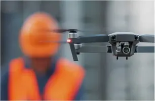
Unmanned Aerial Vehicles capture high-resolution topographic data for large sites. This technology improves safety by reducing fieldwork exposure and accelerates data collection compared to traditional methods. We combine UAV results with ground verification to produce detailed maps for construction planning, environmental assessments, and land development projects.
3D Laser Scanning
Our 3D laser scanning creates precise as-built models for existing structures and sites. This technology supports pre-design analysis and volumetric calculations with millimeter-level accuracy. Applications include facility management, historical preservation, and complex construction projects requiring exact spatial data for planning and documentation purposes.
Land Planning
We provide zoning assistance, feasibility studies, and site layout plans that optimize land use while meeting regulatory standards. Our team integrates survey data and engineering analysis to create functional spaces for residential, commercial, and mixed-use developments. Services include site analysis, infrastructure planning, and presentation materials for approval processes.
People
Shawn Collins
President
Shawn Collins leads Sisemore & Associates with over 25 years of surveying experience. As a licensed Professional Land Surveyor and CFedS participant, he oversees project execution and client relations. His expertise in federal land surveys has earned industry recognition, including the 2025 Oklahoma Small Business Person of the Year award.
Kelly Schmidt
Registered Land Surveyor
Kelly Schmidt specializes in boundary and ALTA surveys with 15+ years of Oklahoma land surveying experience. She manages complex projects requiring precise legal descriptions and easement documentation. Her technical proficiency with GPS and 3D scanning technology ensures accurate data collection for residential and commercial developments.
Ron Leifheif
Registered Land Surveyor
Ron Leifheif focuses on construction staking and as-built surveys. With expertise in roadways and utility infrastructure, he ensures field measurements align with engineering plans. His 20-year career includes managing large-scale projects for public agencies and private developers across Oklahoma's diverse terrain.
Jimmie Hendrickson
Project Manager
Jimmie Hendrickson coordinates surveying and engineering teams for residential subdivision projects. He manages timelines and client communications while ensuring compliance with municipal regulations. His background in site planning and drainage design supports efficient development processes for clients.
Kristie O'Brien
Project Manager
Kristie O'Brien specializes in commercial and campus development projects. She facilitates zoning applications and feasibility studies while coordinating with municipal agencies. Her 12 years of experience include managing multi-disciplinary teams to deliver cost-effective land planning solutions for retail and institutional clients.
Questions
What services does Sisemore & Associates offer?
We provide civil engineering, land surveying, land planning, 3D laser scanning, UAV mapping, and construction layout services for residential, commercial, and public sector projects.
Do you serve areas outside Tulsa?
While based in Tulsa, we serve clients across Oklahoma, including Oklahoma City and surrounding regions for all our surveying and engineering services.
What industries do you work with?
We support residential developers, commercial builders, public agencies, educational institutions, and private landowners with tailored engineering and surveying solutions.
Are you certified for federal land surveys?
Yes, we participate in the Certified Federal Surveyor (CFedS) program, qualified to conduct surveys on federal lands including Indian trust properties.
How does UAV mapping benefit projects?
Drone surveys improve safety by reducing fieldwork exposure, accelerate data collection, and provide high-resolution topographic maps for planning and documentation purposes.
Can you assist with zoning applications?
Our land planning team prepares and processes zoning applications, site plans, and development presentations for municipal approval processes.