Business Details
50+ Years
experience
Precision Engineering & Surveying Services in Anchorage
Established in 1974, BELL and Associates is an employee-owned consulting firm specializing in engineering and surveying services across Alaska and internationally. Our team of professional engineers and surveyors delivers solution-based design, permitting, and construction management services, leveraging cutting-edge technology like 3D-laser scanning and UAV photogrammetry. With a staff of over 60 professionals during peak seasons, we serve federal, state, and private clients in diverse sectors including oil and gas, transportation, and infrastructure development.Our Anchorage headquarters and North Slope office support projects in Alaska's most challenging environments, maintaining a 20+ year lost-time accident-free safety record. We pioneered 3D scanning technology adoption in Alaska and continue to lead with innovative approaches that combine conventional surveying methods with modern technological advancements.
Services
Civil Engineering
Land Surveying
3D Laser Scanning
UAV Services
Subsurface Mapping
Oilfield Work
Construction Management
Topographic Surveys
Mechanical Engineering
GDP Department
Details
- Year established: 1974
Highlights and features
- We have 40+ years of experience in Alaskan engineering and surveying
- We utilize 3D-laser scanning and UAV technology for accurate results
- Our team includes 60+ professionals with Arctic environment expertise
- We maintain a 20+ year lost-time accident-free safety record
- We offer comprehensive services from civil engineering to subsurface mapping
Services
3D Laser Scanning
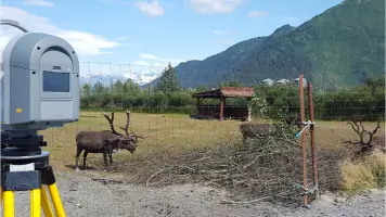
Our 3D laser scanning technology captures precise measurements for complex environments. With over a decade of experience, we provide accurate as-built documentation for oil pads, facilities, and infrastructure projects. Clients access data through user-friendly viewer software without requiring specialized training.
Land Surveying
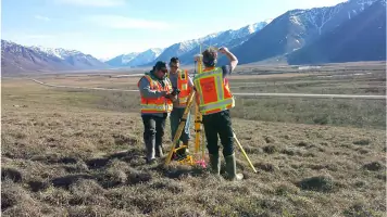
We offer comprehensive land surveying services across Alaska's remote regions. Our expertise includes boundary surveys, topographic mapping, and construction control for projects lasting over 30 years. We specialize in challenging Arctic conditions while maintaining exceptional accuracy standards.
UAV Photogrammetry
Our FAA-certified pilots utilize UAV technology for topographic surveys and infrastructure inspections. With thermal imaging and high-resolution cameras, we conduct safe, cost-effective surveys in Alaska's extreme environments while achieving 0.1' accuracy through combined ground and aerial methods.
Civil Engineering
We provide civil engineering solutions for Alaskan communities including road design, storm sewer systems, and subdivision planning. Our engineers have supported infrastructure development for over 40 years, specializing in cold-region challenges and oilfield site facilities.
Subsurface Mapping
Using ground-penetrating radar and electromagnetic detection, we map subsurface utilities and structures across Alaska. Our services support pipeline projects, gravel road profiling, and permafrost studies while integrating with traditional surveying methods for comprehensive site analysis.
People
Kirstyn Draper
Chief Executive Officer
15-year Alaska resident with 13 years in oilfields. Graduated from University of Alaska Anchorage with Geomatics degree. Expert in network adjustments, design surveys, and construction layout. Holds dual degrees in surveying and business.
Bob Bell
Principal
Founded the company in 1974 with 40+ years of Arctic surveying experience. Senior civil engineer and land surveyor. Developed QA/QC processes for Alaska projects. Holds floatplane pilot license and authored multiple novels.
Chris Burt
Chief Technical Officer
15-year company veteran who established the 3D scanning department. Senior civil engineer with expertise in terrestrial laser scanning equipment. Holds University of Alaska Anchorage civil engineering degree. Provides QA/QC oversight for all scanning projects.
Vivian Santiago
Civil Engineer
Registered engineer in Alaska and Philippines. Joined BELL in 2013 after retail management career. Specializes in civil design and cost estimation. Passed Alaska engineering exam in 2016 after career re-entry.
Brad Rinckey
Senior Survey Manager
23-year Alaska surveying veteran with 15 years in management roles. Supervised up to 18 staff members. Expert in project logistics across Alaska. Holds Alaska Professional Land Surveyor license #1129.
Questions
What engineering and surveying services do you offer?
We provide civil engineering, land surveying, 3D laser scanning, UAV photogrammetry, and subsurface mapping services for infrastructure, oil and gas, and commercial projects.
How long have you operated in Alaska?
We've served Alaska since 1974 with continuous operations on the North Slope since 1980, making us one of the state's most experienced engineering firms.
Do you work in remote Arctic locations?
Yes, we specialize in Alaska's remote environments with offices in Anchorage and Prudhoe Bay, maintaining a 20+ year safety record in extreme conditions.
What technology do you use?
We utilize 3D laser scanning, UAV drones with thermal imaging, and ground-penetrating radar, combining traditional methods with modern technology for optimal results.
What industries do you serve?
We support oil and gas, transportation, infrastructure, commercial development, and government clients with specialized solutions for Alaska's unique challenges.