
Business Details
50+ Years
experience
Emergency
services
Your Trusted Partner for Construction Surveying Solutions
Wilson & Associates, P. C has been a leader in geomatics surveying since 1972, delivering precise data and innovative solutions for construction, infrastructure, and land development projects. Our expertise spans transportation, residential, and commercial sectors, utilizing advanced technologies like LiDAR, 3D modeling, and BIM to ensure accuracy and efficiency. With a team of licensed surveyors, engineers, and technologists, we prioritize client collaboration, technical excellence, and a commitment to resolving complex challenges.Our core values of humility, teamwork, and accountability guide every project, ensuring timely, budget-conscious outcomes. As the largest surveying firm in Tennessee, we combine decades of experience with cutting-edge tools to set industry standards and build lasting client partnerships.
Services
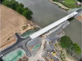
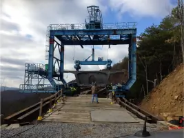
Transportation Construction
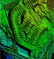
LiDAR Services
Utility Coordination
BIM Modeling
Subsurface Utility Engineering
Data/Machine Modeling
Boundary Surveys
Platting Services
Details
- Year established: 1972
Highlights and features
- We offer 50+ years of experience in construction surveying and geomatics.
- Our team utilizes advanced LiDAR and 3D modeling technologies for accuracy.
- Proven expertise in DOT route surveys and utility coordination projects.
- We provide end-to-end support from land acquisition to project closeout.
- Committed to resolving utility conflicts and minimizing construction delays.
Services
Transportation Construction
Wilson & Associates, P. C provides precise construction surveying for transportation infrastructure, including roadways, bridges, and utilities. Our team ensures accurate layouts, alignment verification, and as-built documentation to meet DOT standards. By integrating LiDAR and 3D modeling, we reduce rework and enhance project efficiency, supporting timely, budget-conscious outcomes for highway and transit projects.
LiDAR Services
Our LiDAR solutions capture high-detail data for complex environments using terrestrial, aerial, and mobile platforms. These scans support design accuracy, clash detection, and real-time field adjustments. Applications include bridge inspections, corridor mapping, and marine surveys, ensuring reliable data for infrastructure planning and construction across diverse terrains.
Utility Coordination
We manage utility conflicts through SUE and route surveys, identifying underground and surface utilities to prevent construction delays. Our proactive coordination with agencies and contractors ensures compliance, reduces risks, and streamlines project timelines. This service is critical for DOT projects requiring precise utility deconfliction and relocation planning.
BIM Modeling
Wilson & Associates, P. C creates data-rich BIM models to enhance project visualization and collaboration. These models integrate survey data for clash detection, construction sequencing, and facilities management. By aligning design with real-world conditions, we improve decision-making, reduce material waste, and support efficient project delivery from design through maintenance.
Subsurface Utility Engineering
Using SUE standards, we locate and map underground utilities to mitigate risks during excavation. Our process includes geophysical detection, test hole verification, and ASCE-compliant reporting. This service ensures safety, avoids costly utility strikes, and supports DOT permitting by providing accurate subsurface data for infrastructure projects.
People
Joey C Wilson II
President & CEO
Joey Wilson leads Wilson & Associates, P. C with over 30 years of experience in surveying and engineering. He drives innovation in LiDAR and 3D modeling, ensuring technical excellence and client satisfaction across transportation and infrastructure projects.
Jonathan Bailey
Vice President & COO
Jonathan Bailey oversees construction surveying services, focusing on precision and efficiency. With expertise in DOT projects, he ensures seamless execution from site layout to final documentation, leveraging advanced technologies to meet client needs.
Jon Slemp
Vice President & CPO
Jon Slemp directs survey design services, specializing in residential and commercial development. His work integrates LiDAR and GIS to deliver accurate site analysis, supporting clients from land acquisition to platting and construction verification.
Questions
What services does Wilson & Associates offer?
We provide construction surveying, LiDAR scanning, BIM modeling, utility coordination, and subsurface utility engineering for transportation, residential, and commercial projects.
How does LiDAR benefit construction projects?
LiDAR captures precise 3D data, improving design accuracy, clash detection, and field adjustments. It reduces rework and supports efficient planning for complex infrastructure.
Do you work on DOT projects?
Yes, we specialize in DOT route surveys, utility deconfliction, and compliance, with decades of experience supporting Tennessee and regional transportation infrastructure.
What areas do you serve?
We operate primarily in Tennessee and North Carolina, with nationwide capabilities for large-scale transportation and development projects.
How do you ensure project accuracy?
We use advanced tools like GPS, LiDAR, and 3D modeling, combined with rigorous QA/QC processes and experienced surveyors to guarantee precision from design to completion.