Business Details
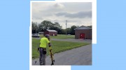
We have been delivering quality engineering and land surveying services in Lebanon, Pennsylvania since 1969. Our firm traces its roots back to 1948 when Richard G. Hockley founded the original practice. In January 2023, we joined forces with Chrisland Engineering to expand our multidisciplinary capabilities. We employ two dedicated field crews equipped with electronic total stations and GPS technology for precise measurements. Our team includes registered surveyors, sewage enforcement officers, and three licensed engineers specializing in civil and structural projects. We utilize three AutoCAD stations in our office to ensure fast turnaround times on all deliverables.
Our staff is overseen by our office manager, Goose the Bulldog, reflecting our unique workplace culture. We have completed major residential, municipal, commercial, industrial, and agricultural projects throughout Lebanon County. Our expertise spans land subdivision design, topographical surveys, flood elevation studies, and on-lot sewage disposal design. We commit to providing accurate, prompt service using the best available equipment and technology. Our combined experience of over 50 years ensures your project is built on solid ground. We strive to maintain the highest professional standards while delivering exceptional value to every client.
Our staff is overseen by our office manager, Goose the Bulldog, reflecting our unique workplace culture. We have completed major residential, municipal, commercial, industrial, and agricultural projects throughout Lebanon County. Our expertise spans land subdivision design, topographical surveys, flood elevation studies, and on-lot sewage disposal design. We commit to providing accurate, prompt service using the best available equipment and technology. Our combined experience of over 50 years ensures your project is built on solid ground. We strive to maintain the highest professional standards while delivering exceptional value to every client.

Highlights and features
- We have over 50 years of continuous operation since 1969.
- Our team includes three licensed civil and structural engineers.
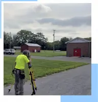
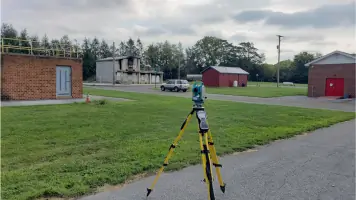
- We use GPS and total stations for precise stakeouts.
- Our AutoCAD stations ensure fast turnaround on all projects.
- We employ registered surveyors and sewage enforcement officers.
Services
Property Surveys
We conduct precise property boundary surveys for residential, commercial, and industrial clients throughout Lebanon County. Our registered surveyors utilize electronic total stations and GPS technology to deliver accurate stakeouts and legal descriptions. These surveys ensure regulatory compliance and prevent costly boundary disputes for property owners.
Topographical Surveys
We provide detailed topographical surveys mapping natural and man-made features for site planning and engineering design. Our field crews employ advanced data collection technology to capture precise elevation contours and existing conditions. This data supports informed decision-making for drainage, grading, and construction layout.
Land Subdivision Design
We design and plan land subdivisions for residential developments, business parks, and municipal projects across Lebanon County. Our engineers coordinate with local authorities to ensure compliance with zoning, stormwater, and sewage regulations. The process integrates survey data, utility planning, and road design for efficient lot creation.
Flood Elevation Studies
We perform flood insurance elevation studies to determine property risk levels and support LOMA applications for homeowners. Our surveyors collect precise elevation data using GPS and total stations to certify flood zone classifications. These studies help clients reduce insurance premiums and meet federal lending requirements.
On-Lot Sewage Disposal Design
We design on-lot sewage disposal systems tailored to site-specific soil conditions and Pennsylvania DEP regulations. Our sewage enforcement officer conducts percolation tests and evaluates soil profiles for optimal system placement. The designs ensure long-term functionality and environmental compliance for residential and commercial properties.