Business Details
23 Years
experience
Professional Land Surveying & Engineering Services in Virginia
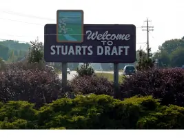
Since 2003, Terra Engineering & Land Solutions, PC has been a trusted partner for civil engineering, land surveying, and planning services across Virginia. Our team combines advanced technology with decades of experience to deliver precise, sustainable solutions tailored to each client's unique needs. Founded by Steven Driver, a professional engineer and surveyor with over 39 years of industry expertise, we maintain a family-run business ethos while operating with the technical rigor of a large firm. Our Stuarts Draft headquarters provides easy access to Harrisonburg, Charlottesville, Waynesboro, and Staunton. We specialize in GPS and robotic surveying, land planning, and environmental stewardship, ensuring projects meet regulatory requirements while maximizing land value.Our collaborative approach prioritizes client goals, offering comprehensive site analysis, zoning compliance, and construction support. With a proven track record in both public and private sector projects, we emphasize cost-efficiency, data-driven decision-making, and long-term environmental sustainability. Our commitment to innovation is demonstrated through integration of emerging technologies like augmented reality and drones. Recognized for honesty and professionalism by clients including real estate developers and municipalities, we maintain transparent communication throughout every project phase. Our office hours are Monday through Friday from 8 AM to 5 PM, with emergency contact options available for urgent matters.

Services
Land Planning
Civil Engineering
GPS Surveying
Robotic Surveying
Land Surveying
Pipeline Surveying
Details
- Year established: 2003
Highlights and features
- We offer 20+ years of combined experience in Virginia land development projects
- Our team utilizes advanced GPS and robotic surveying technologies
- We provide personalized service with large-firm technical capabilities
- Our solutions prioritize environmental sustainability and regulatory compliance
- We serve clients across Harrisonburg, Charlottesville, Waynesboro, and Staunton
What people say
Best honest professionals
Very friendly inviting
Professional experts land development
Services
Land Planning
Our land planning services optimize property use while ensuring environmental sustainability. We conduct comprehensive site analyses considering topography, natural resources, and infrastructure to create development plans that maximize land value. Our team navigates zoning regulations and local ordinances to streamline approval processes for residential, commercial, and mixed-use developments.
Civil Engineering
We provide full-spectrum civil engineering solutions from concept to construction. Our services include road design, drainage systems, and site development plans that balance functionality with cost-efficiency. With expertise in both small-scale renovations and large infrastructure projects, we deliver designs that meet technical requirements while aligning with client objectives.
GPS Surveying
Our GPS-based surveying achieves centimeter-level accuracy for land measurement and mapping. This technology enables efficient data collection for property boundary determination, construction layout, and environmental monitoring. The precise geospatial data supports informed decision-making for development projects and infrastructure planning across Virginia.
Robotic Surveying
We utilize robotic surveying technology to enhance measurement precision and project efficiency. This advanced system reduces field time while maintaining high accuracy for topographic mapping and construction staking. The automated process delivers detailed data that supports better planning decisions for complex development projects.
Land Surveying
Our professional land surveying services establish accurate property boundaries and topographic features. We provide essential data for real estate transactions, legal disputes, and development projects. Using modern equipment and techniques, we deliver precise measurements that meet regulatory requirements and support informed land use decisions.
People
Steven L. Driver
Owner/Principal Engineer & Surveyor
With over 39 years of experience, Steve Driver leads as licensed civil engineer and surveyor. He graduated from Virginia Tech with a civil engineering degree and received a VAS scholarship for surveying licensure. He founded Terra Engineering in 2003.
Anthony Eshleman
CAD Specialist
Anthony brings 8+ years of drafting experience to our team. He studied music and Biblical studies at Rosedale Bible College and completed drafting courses at Piedmont Virginia Community College. He has been with Terra Engineering for over 6 years.
Joseph Driver
Survey Crew Leader
Joe has worked with Terra Engineering since 2003. He holds a Bachelor of Science in Business and Administration from Bridgewater College and is pursuing a Master of Arts in Bible Exposition at Northland International University. He leads our survey crews and manages business operations.
Questions
What services does Terra Engineering offer?
We provide land planning, civil engineering, GPS surveying, robotic surveying, and land surveying services across Virginia.
How long has Terra Engineering been in business?
We've served Virginia communities since our founding in 2003 by Steven Driver.
What areas do you serve?
We primarily serve Stuarts Draft, Harrisonburg, Charlottesville, Waynesboro, and Staunton areas in Virginia.
What makes your surveying services unique?
We combine GPS and robotic technologies with traditional expertise for precise, efficient land measurements.
How do you handle regulatory compliance?
Our team navigates zoning laws and environmental regulations to ensure your project meets all requirements.
What industries do you work with?
We serve real estate developers, construction companies, municipalities, and environmental organizations.