Business Details
35 Years
experience
Your Trusted Partner for Land Surveying & Engineering Solutions
Berks Surveying & Engineering, Inc. (BSE) has been a trusted provider of professional land surveying and engineering services since 1991. Our team combines over 33 years of industry experience with advanced technology to deliver precise and reliable solutions for residential, commercial, agricultural, and municipal projects. Specializing in land development, zoning, and environmental compliance, we guide clients through complex regulatory processes while prioritizing budgetary and design goals. Our licensed professionals utilize cutting-edge GPS and drone technology to ensure accuracy in boundary surveys, stormwater planning, and construction stakeout. With a reputation built on integrity and expertise, we serve homeowners, developers, and municipalities across Pennsylvania.Our commitment to quality is reflected in over 2,500 completed projects and 70,000 acres surveyed. We maintain strong relationships with local authorities to streamline permitting and zoning approvals, ensuring projects meet all legal requirements. Our multidisciplinary approach allows us to offer comprehensive services, from erosion control plans to FEMA elevation certificates, tailored to each client's unique needs. By fostering long-term partnerships, we have become a preferred choice for clients seeking dependable and technically proficient land planning solutions.
Services
Land Surveying
Zoning & Permitting
Environmental Projects
Agricultural Planning
Stormwater Management
Boundary Surveys
Land Development
Erosion Control
FEMA Certificates
Drone Surveys
Details
- Year established: 1991
Highlights and features
- We offer 33+ years of experience in Pennsylvania land surveying and engineering
- Our team uses advanced GPS and drone technology for accurate results
- We provide end-to-end regulatory compliance assistance for municipal approvals
- Our licensed professionals specialize in FEMA elevation certificates and LOMAs
- We serve diverse clients including homeowners, developers, and municipalities
What people say
Professional and timely work
Expert regulatory process navigation
Successful FEMA map amendments
Cost-effective solutions
Exceptional communication
Services
Land Surveying
Professional boundary and topographic surveys using GPS and robotic instruments ensure precise property measurements. Our licensed surveyors provide ALTA/ACSM standards compliance for real estate transactions, construction projects, and legal documentation. Services include construction stakeout, FEMA elevation certificates, and subdivision mapping.
Land Development
Comprehensive land development plans covering subdivision, annexation, and municipal improvement projects. Our team creates phased development strategies that balance client goals with regulatory requirements. Services include driveway design, septic system planning, and state highway occupancy permits for residential and commercial properties.
Environmental Compliance
Specialized erosion and sedimentation control plans for projects disturbing one acre or more. We manage NPDES permitting processes and create stormwater management solutions meeting municipal requirements. Services include nutrient balance sheets, manure management plans, and NRCS 590-compliant agricultural facility designs.
Zoning & Permitting
Expert guidance through local zoning ordinances and permitting processes. Our team prepares site plans for municipal review and represents clients at planning commission meetings. Services include legal description preparation, access permitting, and compliance strategies for residential, commercial, and agricultural developments.
Agricultural Planning
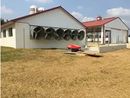
Tailored solutions for Pennsylvania farm families including nutrient management plans and expansion strategies. Our specialists create USDA-compliant conservation plans and assist with agricultural facility permitting. Services integrate environmental stewardship with operational efficiency for 9th-generation farming operations and modern agribusinesses.
People
Robert D. Hain
President/Principal
Licensed PA Surveyor and Drone Pilot with 26+ years of experience. Oversees daily operations and client relations while managing complex land development projects. Expert in stormwater planning and municipal regulatory compliance.
Bruce T. Rader
Founder
Established BSE in 1991 with 32+ years of engineering and surveying expertise. Specializes in GPS technology and land development projects across five Pennsylvania counties. Provides strategic oversight for municipal planning and zoning initiatives.
Cindy A. Cunard-Hogan
Office Manager
Manages financial operations and HR functions with 18+ years of service. Combines communications design expertise with hands-on surveying experience from family surveying background. Maintains quality assurance procedures for engineering documentation.
Amanda Marbarger
Ag Planning Specialist
9th-generation Berks County farmer with specialized agricultural planning expertise. Develops nutrient management plans and assists clients with zoning compliance. Brings practical farming knowledge to land development and environmental projects.
Daniel A. Graybill Jr.
Project Manager
Project manager with 18+ years of experience in land surveying and civil design. Specializes in subdivision planning and erosion control strategies. Coordinates technical teams to deliver comprehensive site development solutions.
Questions
What surveying services do you offer for residential properties?
We provide boundary surveys, FEMA elevation certificates, and site planning for home additions, pools, and driveways. Our services ensure compliance with local zoning requirements.
Can you assist with agricultural land development projects?
Yes, we specialize in agricultural planning including nutrient management, manure storage design, and farm expansion projects with USDA-compliant documentation.
Do you handle municipal permitting for commercial developments?
Our team prepares comprehensive land development plans and represents clients during zoning board approvals for commercial projects across Pennsylvania.
What environmental compliance services are available?
We offer erosion control plans, NPDES permitting, and stormwater management solutions meeting state and federal regulations for projects over one acre.
How do you handle payment for surveying services?
We accept credit card payments through our secure portal and offer flexible payment options including retainer agreements for large projects.
What areas do you serve for land surveying projects?
We primarily serve Berks County, Greater Reading, Allentown, and adjacent Pennsylvania counties with specialized local regulatory knowledge.