Business Details
46 Years
experience
Trusted Civil Engineering Services in Omaha
Established in 1980, R W Engineering & Surveying has built a reputation for delivering high-quality civil engineering, land surveying, and geospatial solutions across Nebraska, Iowa, and beyond. Our team of licensed professionals combines decades of experience with cutting-edge technology, including 3D laser scanning, mobile LiDAR, and FAA-certified drone operations, to provide precise and efficient services. We specialize in sustainable infrastructure design, boundary and topographic surveys, and construction administration, prioritizing client satisfaction through rigorous quality control and a commitment to project timelines and budgets.Our expertise in parks, roadways, and commercial developments has supported community growth while maintaining environmental consciousness. With offices in Omaha, Lincoln, Council Bluffs, and Des Moines, we serve both public and private sectors, backed by a million-dollar professional liability insurance policy for client assurance.
Services
Civil Engineering
Land Surveying
Aerial Mapping
3D Laser Scanning
Mobile Mapping
GIS Services
Construction Administration
Details
- Year established: 1980
Highlights and features
- We offer 45+ combined years of experience in civil engineering and land surveying.
- Our team utilizes FAA-certified drones and 3D laser scanning for high-accuracy data.
- We provide comprehensive services from design to construction administration.
- Our million-dollar liability insurance ensures client protection and project security.
- We serve multiple states with offices in Omaha, Lincoln, and Des Moines.
What people say
Professionalism of team
Evident from day one
Services
Civil Engineering
Our civil engineering services focus on sustainable infrastructure projects, including roadway design, parks, and commercial developments. We handle projects from conceptual planning to construction administration, ensuring compliance with environmental regulations and community needs. With decades of experience, we deliver cost-effective solutions that enhance quality of life while prioritizing safety and longevity.
Land Surveying
We provide comprehensive land surveying, including boundary, topographic, and construction surveys. Our licensed professionals use advanced tools like GPS and LiDAR to ensure precision for projects ranging from small parcels to large-scale developments. Backed by a million-dollar liability insurance policy, we guarantee accurate, legally compliant results tailored to client needs.
Aerial Mapping
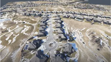
Our FAA-certified drone pilots capture high-resolution aerial data for mapping, volumetric analysis, and inspections. This technology enables efficient site monitoring, orthomosaic imagery, and 3D modeling, reducing field time and costs. Ideal for construction progress tracking, infrastructure assessments, and marketing visuals, our services combine speed with survey-grade accuracy.
3D Laser Scanning
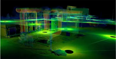
We utilize terrestrial and mobile LiDAR to create detailed 3D models for as-builts, clash detection, and infrastructure analysis. These scans support adaptive reuse, facility management, and pre-construction planning, offering millimeter-level precision. Our deliverables integrate with BIM and CAD software, ensuring seamless design and construction workflows for complex projects.
Mobile Mapping
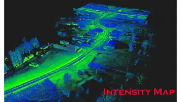
Our mobile LiDAR systems rapidly collect high-accuracy data for large-scale corridor surveys, roadways, and utility corridors. This technology minimizes traffic disruption and field time while providing detailed topographic and asset data. Ideal for highway planning, pavement analysis, and GIS integration, our solutions enhance efficiency and safety for transportation and infrastructure projects.
People
Russell W. Falconer
Principal, Civil Engineer
With 30 years of experience, Russell leads civil engineering projects, specializing in sustainable infrastructure. He holds a PE license and contributes to engineering associations, ensuring RWs designs meet evolving industry standards.
Joel S. Jacobsen
Principal, Land Surveyor
Joel oversees land surveying operations with 35 years of expertise. A licensed PLS, he ensures precision in boundary surveys and topographic mapping, leveraging decades of field and technical knowledge.
Brian L. Yentes
Vice President, Land Surveyor
Brian manages surveying projects across multiple states, holding licenses in NE, IA, SD, and KS. His 26 years of experience ensure compliance and accuracy in complex land development initiatives.
Scott M. Braun
Associate, Civil Engineer
Scott contributes to engineering design with 12 years of experience. A licensed PE, he focuses on roadway and site development projects, integrating sustainable practices into RWs solutions.
George A. Hunt
Project Engineer
George specializes in environmental engineering with 23 years of experience. His PhD and PE license support RWs expertise in stormwater management and regulatory compliance for diverse projects.
Questions
What services does R.W. Engineering & Surveying offer?
We provide civil engineering, land surveying, aerial mapping, 3D laser scanning, mobile LiDAR, GIS, and construction administration services for public and private clients.
How long has R.W. Engineering been in business?
We’ve served clients since 1980, offering over four decades of expertise in engineering and surveying solutions.
Do you operate outside Nebraska?
Yes, we work across Iowa, South Dakota, Kansas, and California, with offices in Omaha, Lincoln, Council Bluffs, and Des Moines.
What technologies do you use?
We employ FAA-certified drones, 3D laser scanning, mobile LiDAR, and GIS software to ensure precision and efficiency in all projects.
How can I request a quote?
Contact us via phone or our website to discuss your project needs and receive a customized estimate from our team.