Business Details
21 Years
experience
Professional Civil Engineering & Land Surveying Services in Columbus, Ohio
Founded in 2005, Willis Engineering & Surveying brings over 25 years of combined experience in civil engineering and land surveying. Our team of licensed professionals specializes in boundary surveys, site development, floodplain analysis, and infrastructure design across Central Ohio. We prioritize precision, client collaboration, and adherence to industry standards, ensuring reliable solutions for residential, commercial, and public projects. Our reputation for timely delivery and technical excellence has earned us long-term partnerships with developers, municipalities, and private clients. 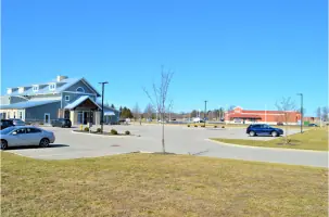
Services
Boundary Surveys
Property Line Staking
House Site Plans
Flood Elevation Certificates
Subdivisions
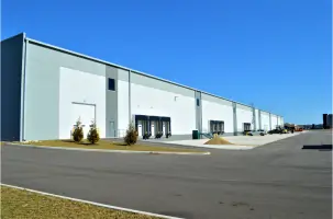
Commercial Development
Public Infrastructure
Topographic Surveys
Floodplain Studies
Lot Consolidation
Details
- Year established: 2005
Highlights and features
- We offer 25+ years of combined experience in civil engineering and land surveying.
- Our team includes licensed engineers and surveyors directly managing projects.
- We provide competitive pricing without compromising technical accuracy.
- Our work meets strict deadlines for residential and commercial developments.
- We maintain long-term client relationships through transparent communication.
What people say
Most dependable company
Top-notch expertise
On time and on budget
Accurate work
Prompt service
Services
Boundary Surveys
Our boundary surveys precisely determine property lines using historical records and field measurements. We prepare legal descriptions and set monuments to resolve disputes or support real estate transactions. Clients receive detailed maps and documentation compliant with Ohio surveying standards.
Site Development
We design site layouts for residential and commercial projects, including roadways, utilities, and stormwater systems. Our plans ensure zoning compliance and efficient land use. Services cover feasibility studies through construction documentation for developments of all sizes.
Floodplain Studies
Our floodplain analysis identifies flood risks using FEMA standards. We prepare elevation certificates and coordinate with agencies to remove properties from flood zones. This helps clients reduce insurance costs and meet regulatory requirements for construction in vulnerable areas.
Subdivisions
We handle complete subdivision design from initial surveys to final plat recording. Services include boundary determination, road alignment, utility layout, and stormwater management. Our team ensures compliance with municipal codes for residential and commercial parcel splits.
Topographic Surveys
Our topographic surveys map terrain features and existing utilities using advanced equipment. These surveys support construction planning, drainage design, and environmental assessments. Clients receive detailed base maps showing elevations, structures, and natural landforms.
People
Todd Willis
Owner/Professional Engineer & Surveyor
Todd Willis, a licensed engineer and surveyor with 25+ years of experience, founded the company in 2005. He specializes in civil engineering design and boundary surveys, having worked on diverse projects from residential subdivisions to industrial developments across Ohio.
Questions
What services does Willis Engineering and Surveying offer?
We provide boundary surveys, site development plans, floodplain analysis, subdivisions, commercial development design, and public infrastructure engineering across Central Ohio.
How long has the company been in business?
Willis Engineering and Surveying was founded in 2005, with our lead engineer having over 25 years of industry experience.
What areas do you serve?
We operate throughout Central Ohio, including Columbus, Newark, Hebron, Canal Winchester, and Circleville for residential and commercial projects.
Can you handle complex development projects?
Yes, we specialize in challenging projects requiring FEMA coordination, stormwater management, and infrastructure design for both public and private clients.
How do you ensure project accuracy?
Our licensed engineers and surveyors use advanced technology and follow strict quality control protocols to guarantee precise measurements and designs.