Business Details
Your Trusted Partner for Geospatial Surveying
Muxlow Surveying is an experienced small business specializing in local boundary surveys, transportation, federal, state, energy, and industrial/commercial design surveying throughout Michigan and the Great Lakes Region. Our firm holds WOSB certification, MDOT DBE certification, and MDOT prequalification, demonstrating our commitment to industry standards and client trust. We deliver precision geospatial services to diverse clients, including local residents, Fortune 500 companies, and government agencies, combining technical expertise with advanced technologies like UAV mapping and mobile LiDAR.Our team prioritizes quality control, client collaboration, and humanitarian initiatives, ensuring reliable solutions for complex surveying challenges. With decades of collective experience, we maintain a reputation for accuracy, compliance, and ethical service delivery across public and private sectors.
Services
Boundary Surveys
Mobile LiDAR Mapping
ALTA Surveys
Topographic Surveys
Hydrographic Surveys
UAV Mapping
Right of Way Surveys
Legal Description Preparation
MDOT Road Design Surveys
Consulting Services
Highlights and features
- We specialize in boundary, transportation, and energy sector surveying with advanced LiDAR and UAV technology.
- Our team holds WOSB and MDOT DBE certifications for government and infrastructure projects.
- We serve diverse clients from private landowners to Fortune 500 companies.
- Our work supports humanitarian and social projects globally.
- We provide ALTA/NSPS standards-compliant surveys for title insurance and property transactions.
Associations and certifications
- WOSB
- MDOT DBE Certified
- MDOT Prequalified
What people say
Fits like a glove
Great work again
Hats off to staff
Services
Boundary Surveys
We conduct precise boundary surveys to establish property corners, resolve disputes, and create legal descriptions. Our services include land divisions, easement mapping, and line staking for residential, commercial, and agricultural properties. Clients receive accurate documentation compliant with local regulations and title insurance requirements.
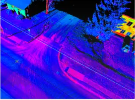
Mobile LiDAR Mapping
Our mobile LiDAR systems capture high-resolution topographic data for infrastructure, transportation, and environmental projects. This technology enables rapid data collection in challenging terrains while maintaining sub-centimeter accuracy. Applications include roadway modeling, utility mapping, and volumetric analysis for construction and resource management.
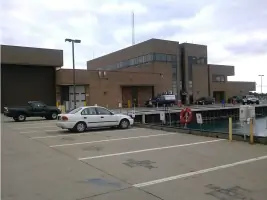
Hydrographic Surveys
We perform hydrographic surveys using manned and unmanned vessels to map underwater terrain. Our services support coastal engineering, bridge inspections, and water resource management. Clients receive detailed bathymetric charts and 3D models for dredging, habitat assessment, and floodplain analysis projects.
UAV Mapping
Our FAA-certified UAV operators capture aerial imagery for photogrammetric mapping and site analysis. This service provides cost-effective data collection for large areas, supporting land development, construction monitoring, and environmental assessments. Deliverables include orthomosaics, digital elevation models, and GIS-ready datasets.
ALTA Surveys
We deliver ALTA/NSPS-compliant boundary surveys for commercial real estate transactions. These surveys identify property boundaries, easements, and improvements per title insurance requirements. Clients receive detailed maps and certifications to mitigate legal risks during property acquisitions and financing.
People
Brad Cole
Certified Photogrammetrist
Brad Cole is a certified photogrammetrist with ASPRS, specializing in aerial mapping and geospatial data analysis. He leads UAV operations and photogrammetric processing, ensuring high-accuracy deliverables for infrastructure and environmental projects.
Questions
What geographic areas does Muxlow Surveying serve?
We primarily serve Michigan and the Great Lakes Region, with capabilities for federal and energy sector projects nationwide.
What certifications does Muxlow Surveying hold?
We are WOSB-certified, MDOT DBE-certified, and MDOT-prequalified for transportation and infrastructure projects.
Do you provide hydrographic survey services?
Yes, we conduct bathymetric surveys using manned and unmanned vessels for underwater terrain mapping and analysis.
What technologies does Muxlow use for surveying?
We utilize UAV mapping, mobile LiDAR, photogrammetry, and traditional surveying equipment for comprehensive data collection.
Can Muxlow perform ALTA/NSPS boundary surveys?
Yes, we provide ALTA-compliant boundary surveys for commercial properties, including title insurance requirements.
